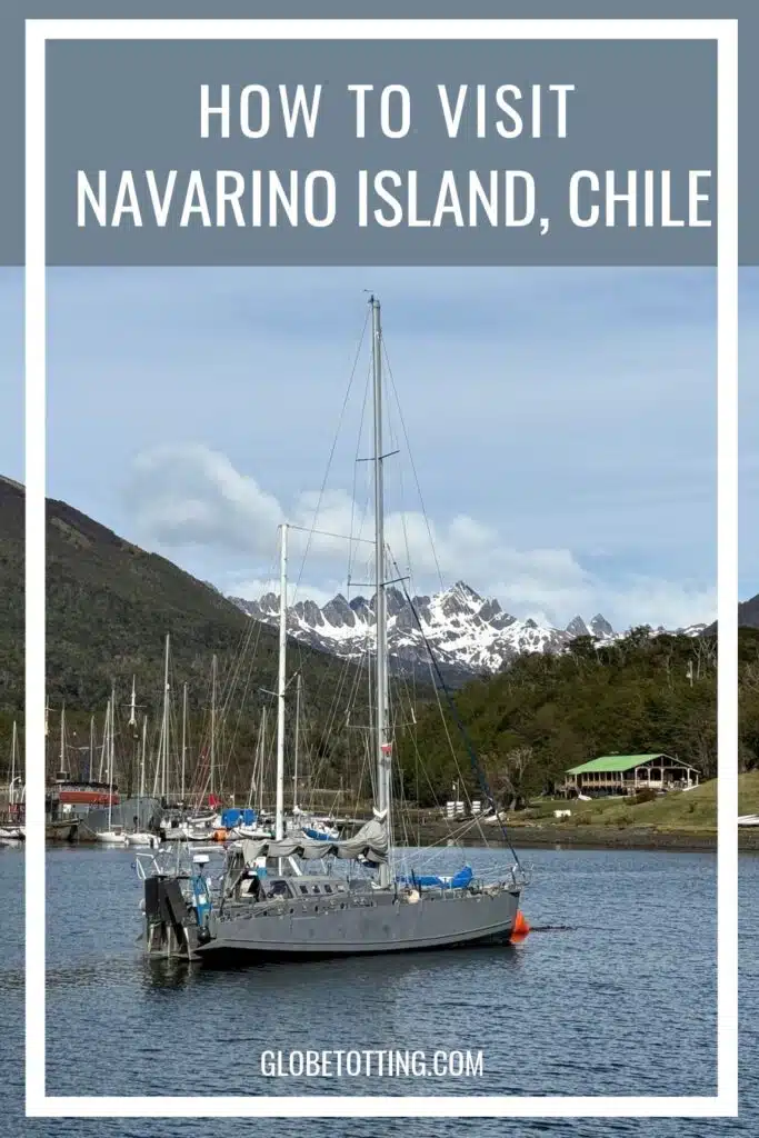
“The weather is the boss in Patagonia,” said Pepa, our guide from Chile Nativo Travel. “Hopefully we’ll have a smooth flight but it can be very bumpy.”
Boarding the Beechcraft King Air 300 aircraft in Punta Arenas, on the heel of Chile in South America, I find my seat and get settled for the hour-long flight to Navarino Island.
Perched at the bottom of the Americas in the windswept Tierra del Fuego archipelago, once-upon-a-time the only way you could reach Navarino Island was by overnight ferry. Nowadays, however, it’s a quick hop, skip and often bumpy flight to the end of the world.
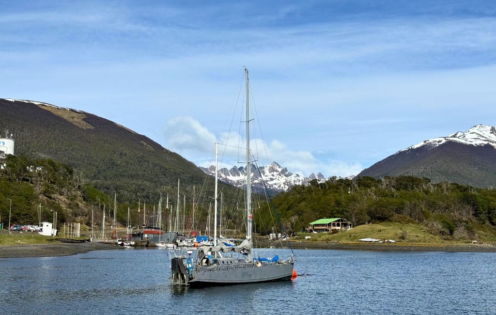
These days it can feel hard to find places that are truly off the beaten path but Navarino Island in Chilean Patagonia really does feel like a remote outpost. Peering out of the scratched airplane window, the only thing I can see below me is the glacier-covered Darwin Range, a vast expanse of mighty peaks, deep fjords and ice fields.
But despite its isolated location and seemingly inhospitable geography, change is also happening in this corner of the world, which is why now is a great time to visit Isla Navarino.
Disclosure: This post may contain affiliate links. I have been or could be if you click on a link in this post compensated via a cash payment, gift or something else of value for writing this post. See our full disclosure policy for more details.
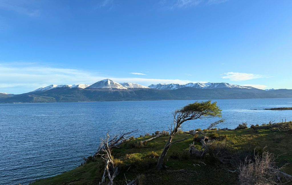
Navarino Island at a glance
Table of Contents
- Where: Navarino Island (Isla Navarino in Spanish) sits in the Magallanes y la Antártica Chilena region (the official name). Punta Arenas is the region’s biggest city and the starting point for trips south to the island. The island lies south of the Beagle Channel, across from Ushuaia in Argentina.
- Size: Navarino Island covers an area of 2,514 square kilometres (971 square miles).
- Main town: Puerto Williams was founded in 1953 as a naval base, although the Indigenous Yagán people have lived here for more than 10,000 years. According to the last census, Puerto Williams has a population of 1,608, and the island’s population is around 2,000. Most visitors stay in and around Puerto Williams.
- Other settlements: Puerto Toro on the island’s eastern coast, Puerto Navarino on the western side along the Beagle Channel, and Río Guanaco in the interior of the island.
- Getting there: Flights from Punta Arenas take between 40 minutes and 1 hour 15 minutes. The ferry from Punta Arenas takes 32–36 hours, and crossings from Ushuaia in Argentina take approximately 45 minutes.
- Best time: The visitor season runs roughly from October to April. Almost nobody visits between June and August, when it’s too cold and there’s too much snow.
- Fun fact: There’s only one petrol station on the island, and it routinely has the most expensive petrol in Chile.
Is Navarino Island worth visiting?
In a word yes. This is a truly wild and wondrous destination, and one that few people get to visit (only around 10,000 visitors arrive each year because of its remote location). As my guide, Pepa, said “Navarino Island is like Torres del Paine was 20 years ago.”
The island has some excellent hiking, including the famous Dientes de Navarino trek, which receives a tiny fraction of the number of hikers that attempt the famous W Trek in Torres del Paine National Park. It has a fascinating (and heartbreaking) history, a rich local culture and is home to the southernmost forest on Earth.
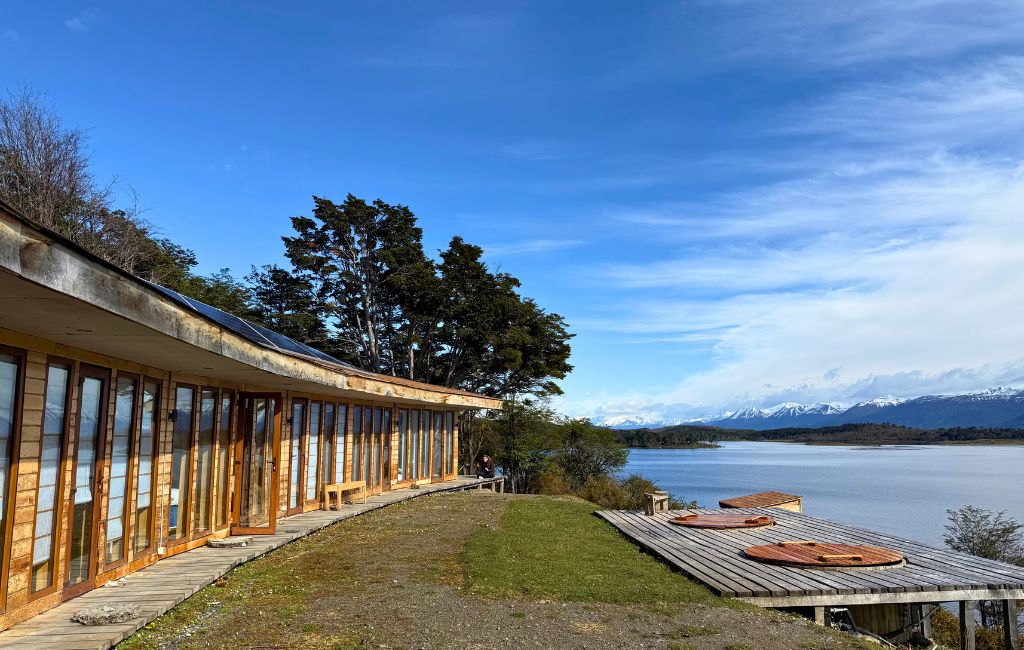
Plus, there are some truly fantastic guides who can help you explore and understand the island, as well as the excellent Errante Ecolodge, with views overlooking the Beagle Channel, which makes the perfect base.
If that doesn’t persuade you then come so that you can say that you have visited the southernmost town on earth. Although Ushuaia in Argentina likes to claim that title, the reality is that Puerto Williams holds the crown.
It’s also worth visiting Navarino Island soon because, despite its remote location, change is coming to this Chilean island. A new hotel, The Cormorant at 55 South, has just opened on the island. Purpose-built for Silversea cruise passengers only (Silversea is part of Royal Caribbean) the hotel project has reportedly divided the island.
In addition, the Chilean state is currently building a road across the Andes of Tierra del Fuego, from Pampa Guanacos in the north down to Yendegaia Bay on the Beagle Channel. From there, a one-hour vehicle ferry to Puerto Navarino would link it to the island’s Y-905 road, so you could eventually drive all the way to Puerto Williams on Chilean territory.
In short, change is coming and while that is not always a bad thing, it’s worth visiting this southernmost settlement before things change too much.
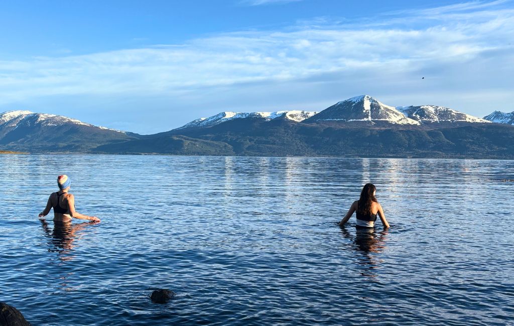
Map of Navarino Island
- North coast: Beagle Channel. The only real road runs along this shore, east to west, through Puerto Williams.
- Puerto Williams: Roughly central on the north coast. All services are here.
- Errante Ecolodge: The best place to stay on the island
- Omora Ethnobotanical Park: A short way west of town.
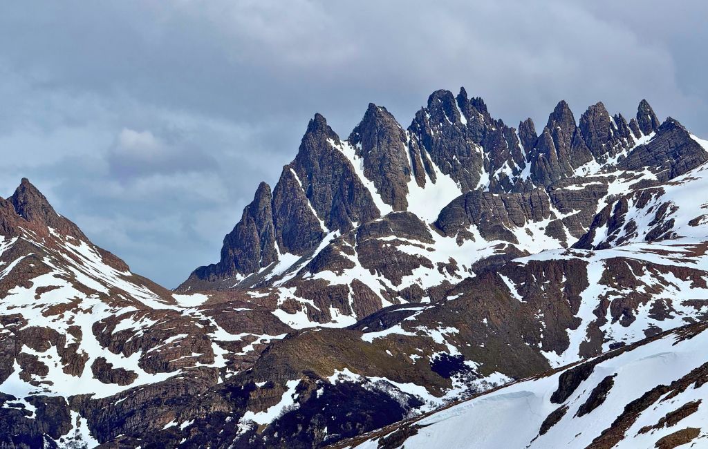
- Dientes de Navarino: The jagged peaks directly south of Puerto Williams.
- Puerto Navarino: At the western end of the road. Boats from Ushuaia often land here.
- Wulaia Bay: West coast, facing the Murray Channel. It has historic links to Darwin’s voyage and to the Yaghan.
- Puerto Toro: East coast, reached mainly by boat.
- Lago Windhond: A large lake in the island’s interior, reached on a separate multi-day trek.
- Across the channel: Ushuaia, Argentina, visible from the Puerto Williams shoreline.
How to get to Navarino Island
There are three main routes and all of them are weather dependent and both flights and ferry sailings can be cancelled because of high winds. It’s worth building in a spare day at each end of your trip to accommodate bad weather conditions.
| Route | What to know |
|---|---|
| Flight from Punta Arenas | Between 40 minutes to 1 hour 15 minutes on a small aircraft with stunning views of the Darwin Range. Seats can sell out in summer, so it’s worth booking early. Baggage limits are strict, so check before packing trekking kit – I left a bag in Punta Arenas and just bought a small backpack with me. |
| Ferry from Punta Arenas | Between 32 – 36 hours through the Patagonian channels, passing glaciers. Departures run a few times a month. Reclining seats or simple cabins, with meals usually included. |
| Boat from Ushuaia (Argentina) | A short, 45-minute crossing of the Beagle Channel, usually only available in summer only. Some services land at Puerto Navarino, followed by a road transfer to Puerto Williams. It is expensive per person and often cancelled in high winds. |
| Private yacht or expedition cruise | Some Cape Horn and Antarctic voyages, including Silversea, call in at Puerto Williams although time on the island is often limited. |
When to visit Navarino Island
Navarino has a cool, windy sub-Antarctic climate. Summer is mild at best, and snow can fall in any month. I visited in early October, at the start of the season, and was lucky that my trip coincided with blue skies and sunshine (and only a little bit of rain). Not long after I left, however, it snowed!
December to February is peak summer with long days and up to around 17 hours of light. Highs typically sit in the low teens celsius. This is the best time for the Dientes del Navarino trek.
March to April. Autumn is when the southern beech forests turn red and gold. There are fewer visitors and shorter days. Trekking is still possible early in the season, but expect colder nights.
May to August is winter in Chile when you can expect short days, snow and freezing temperatures. There’s not a lot open during these months.
September to November delivers changeable weather with snow lingering on the high passes.
How long to stay + sample 5-day itinerary
How long should you stay on Navarino Island?
- 2 to 3 days: A short stay will allow you to visit Puerto Williams, the Martin Gusinde Anthropological Museum, and the Omora Park. You will also have time to hike to Cerro Bandera.
- 5 days: Five days gives you more time to enjoy the island including kayaking and horseback riding adventures with local guides.
- 6 to 8 days: Time to complete the full Dientes circuit and still see the town.
- Always add 1 to 2 buffer days for transport / weather delays.
Sample 5-day itinerary
This does not include the full Dientes de Navarino trek.
Day 1: Arrive
- Land at Puerto Williams and check in.
- Take a walk through town, along the waterfront and past the harbour.
- Visit the Martín Gusinde Anthropological Museum if it is open.
- Relax in Errante Ecolodge and discuss the next day’s activities with Jorge, the owner.
Day 2: Dientes de Navarino
- Experience the start of the Dientes de Navarino circuit with a half-day/day walk up to Cerro Bandera (the flag viewpoint) and onwards to hilltop for views of the Dientes themselves.
Day 3: Forests and Yagán heritage
- Spend the morning at the Omora Ethnobotanical Park.
- Visit the Martin Gusinde Anthropological Museum if you haven’t already.
- Enjoy a Pisco tasting and dinner at the Worus Resto-Bar, “the southernmost bar in the world”.
Day 4: Coast and wildlife
- Join David Alday Chiguay for a kayaking trip along the coastline, learning about the indigenous Yagán People.
- Alternatively, join a horse riding adventure across the island.
- Visit Maria-Luisa and Francisco at Santa Rosa Estancia for the Yagán tradition of “onces”.
Day 5: Boat trip
- Take a boat trip to discover some of the incredible scenery, stopping at Isla Grande de Tierra Fuego for a hike and to see glaciers.
A brief history of Navarino Island
- Thousands of years ago: The Yagán (also spelled Yaghan and also known as Yamana) settle the channels. They are a nomadic people who travel in long bark canoes and live by fishing, gathering shellfish and hunting sea mammals. They keep fires burning in their canoes and along the coastline, which inspires the name “Tierra del Fuego”, Land of Fire.
- 1826–1830: HMS Beagle, under Robert FitzRoy, journeys to Navarino Island during the first survey voyage. FitzRoy kidnaps four Indigenous Fuegians: three Kawésqar (Alakaluf) people and one Yagán, who was known as Jemmy Button. He takes them back to England with the goal of “civilising” them.
- 1831–1833: FitzRoy returns to Tierra del Fuego, this time carrying Charles Darwin on board, and returns the three surviving Fuegians to their homes.
- 1850s: Anglican missionaries attempt settlement. Several are killed in a violent clash at Wulaia in 1859.
- Late 1800s: Gold is discovered and the island becomes a mining hub, with prospectors working across Navarino and the surrounding waterways. The sudden influx of foreigners brings introduced diseases and territorial displacement, which lead to a catastrophic decline in the Yagán population.
- 1946: North American beavers are introduced to Tierra del Fuego for a fur trade. With no natural predators, they spread and reshape the island’s rivers and forests.
- 1950s: Chile founds a naval settlement that becomes Puerto Williams. It is named after John Williams Wilson, a 19th-century British-born Chilean naval commander and politician who established Fuerte Bulnes, a fort on the Strait of Magellan.
- 2005: UNESCO recognises the Cape Horn Biosphere Reserve.
- 2019: Chile grants Puerto Williams official city status, making it the southernmost city in the world.
- 2022: Cristina Calderón, widely recognised as the last native speaker of the Yagán language, dies. Her granddaughter and family continue to work to keep the language and culture alive.
Things to do on Navarino Island
Dientes de Navarino Circuit
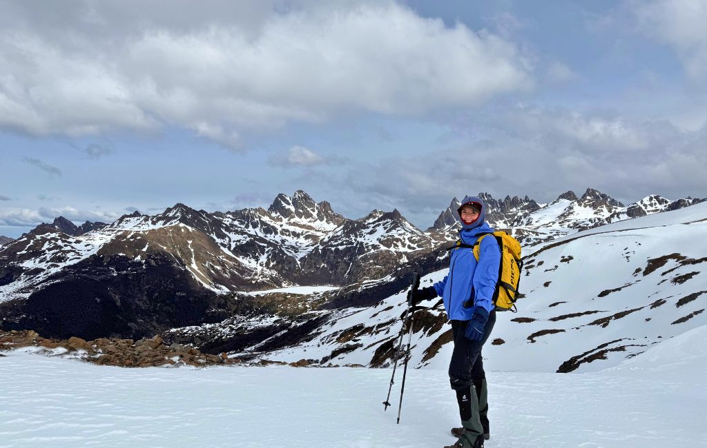
The Dientes de Navarino, the “teeth of Navarino”, is the world’s southernmost multi-day trekking route. Beginning and ending in Puerto Williams, it’s an approximately 50km, four to five-day multi-hike through what can be very challenging terrain (high alpine passes, deep peat bogs, steep loose-rock scree), accompanied by what can be very challenging and changeable weather.
The route is entirely unsupported with not huts or reliable mobile service; you’ll have to carry everything with you, including a tent, sleeping bag, stove, food, a GPS, and maps.
I didn’t have time to do this during my trip although I would love to go back and try it one day. Only 1,000 to 2,000 people complete this trek every year (compared to tens of thousands who complete the W Trek in the Torres del Paine National Park). If you do want to try the trek, then I would highly recommend hiking with a guide, unless you are a very experienced hiker and comfortable with being entirely off grid.
Javier Estay is the founder of Wild Navarino, a small ecotourism agency that runs tours across the island. I spent several days with Javier while I was on Navarino Island and I could not recommend him more highly. Trustworthy, experienced and highly knowledgeable, he has also hiked the Dientes de Navarino circuit numerous times.
If you do plan to do this trek then it might be worth buying trekking food in Punta Arenas or Ushuaia before you arrive as local supplies are limited and prices are high.
Cerro Bandera Hike
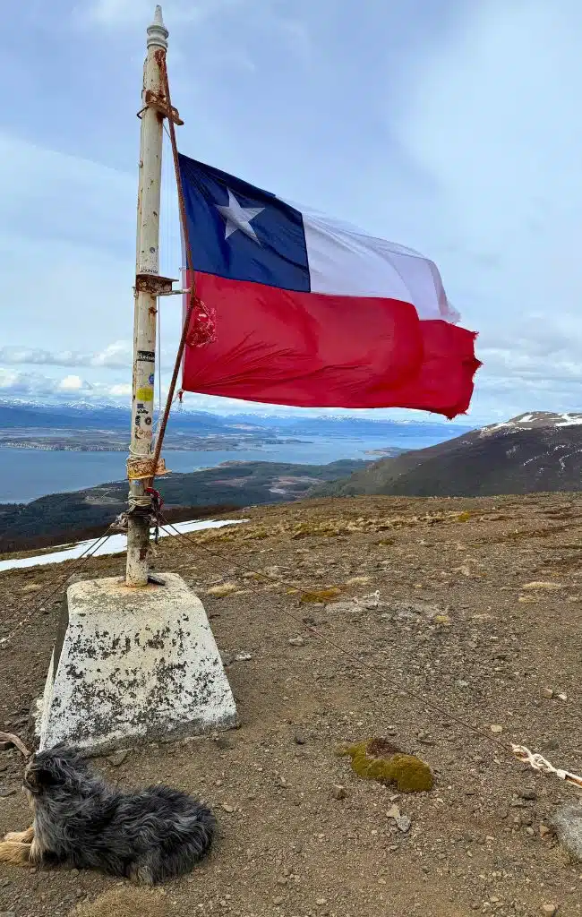
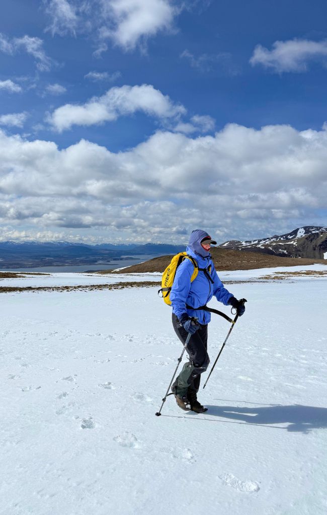
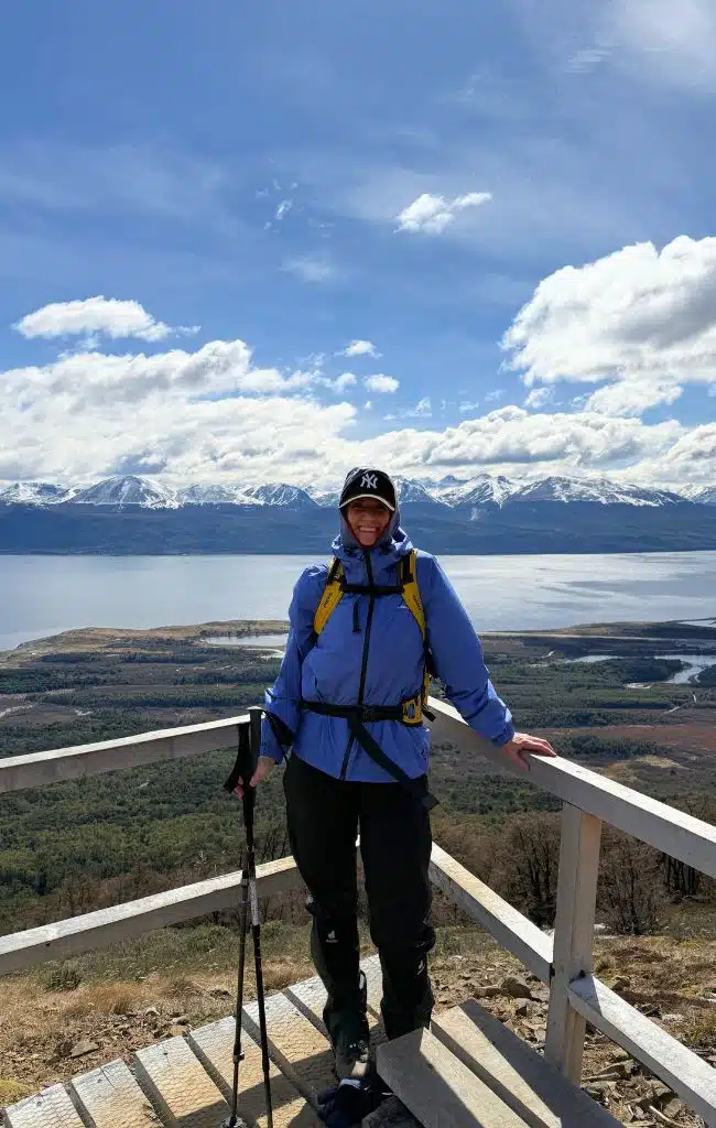
If you don’t have the time (or inclination!) to do the full Dientes de Navarino circuit then make sure you try this hike instead. This is one of three heritage routes (rutas patriomoniales) on the island and follows the first stretch of the island’s famous circuit. The walk, which starts just outside of Puerto Williams, climbs from sea level into the forest, past the treelike and up to a the oversized Chilean flag and then to a viewpoint over the jagged, saw-tooth peaks known as the “dientes” (teeth).
We joined Javier from Wild Navarino for this hike and while you can do it without a guide, I would highly recommend using one. Not only do you learn so much about the island but it helps to have a guide when you’re in a destination where the weather and conditions can change so rapidly.
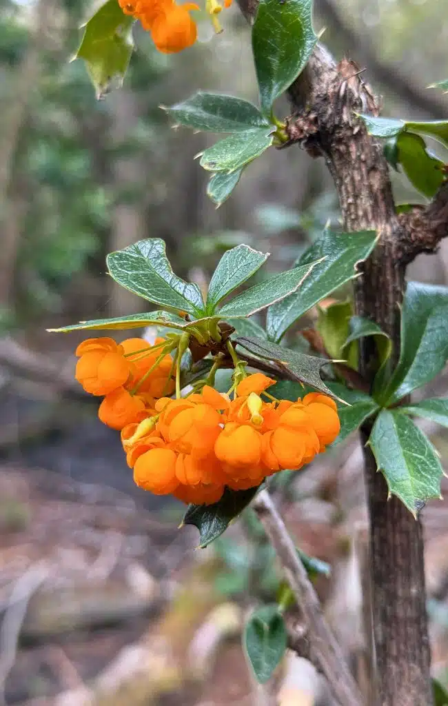
The first part of the trail is a gentle climb through southern beech forest across a tangle of tree roots, slippery after the rain. Javier pointed out the two main trees, lenga and coigüe, the latter was used by the Yagan people to make their canoes. He also pointed out the knobbly clumps of fungus attached to the tree trunks, explaining that these eventually turned into bright orange balls knowns as pan de indio (“Indian bread”), and they’re edible. Higher up in the branches hang round growths called “Chinese lanterns”, a type of parasite. Locals steep them in alcohol and sugar for a year to make licor de farolito chino, a kind of sweet, herbal liquor.
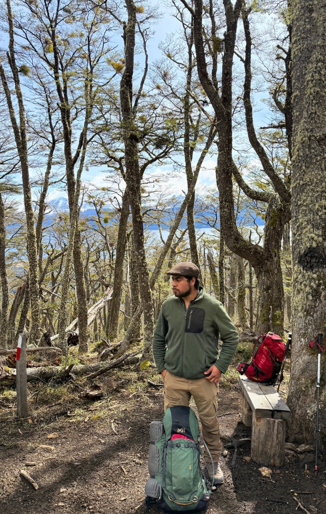
As we climbed, the forest changed around us. The trees near the bottom had been lush and green, as we neared the tree line however, they were stunted, their trunks bent double by the often ferocious winds and the weight of the winter snow. We stopped at the treeline to put on gaiters and another layer before emerging into the open.
There’s a viewpoint not far from the treeline that overlooks the Beagle Channel below and the mountains of Argentina beyond. Javier explained that the channel was once filled by a huge glacier, and that Gable Island below us is made of the sediment it left behind. It was through these waters that FitzRoy and Darwin sailed aboard the Beagle, travelling from east to west.
Javier also pointed out the sphagnum moss, large patches of red that form part of the vast peat bogs left behind as the glaciers retreated. Built up over thousands of years, Patagonia’s peatlands are among the most important natural carbon stores on the planet.
As we continued our climb we reached Cerro Bando, a false summit where an oversized Chilean flag flapped ferociously in the wind. From there, the trek continued upwards, through the snow, towards the point where we had unobstructed views of the island’s famous granite pinnacles.
Altogether the hike takes 3 – 4 hours. We stopped for a picnic lunch on our way down, eating sandwiches and drinking hot tea while sat among the forest.
Omora Ethnobotanical Park (Parque Etnobotánico Omora)
A few kilometres outside of Puerto Williams lies the southernmost forest on Earth. The Omora Ethnobotanical Park (Parque Etnobotánico Omora) takes its name from the Yagan word for hummingbird and is one of the most fascinating places on the island.
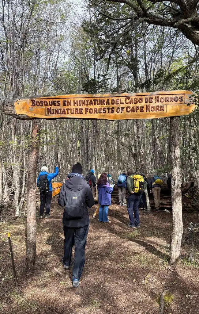
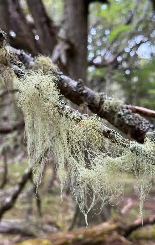
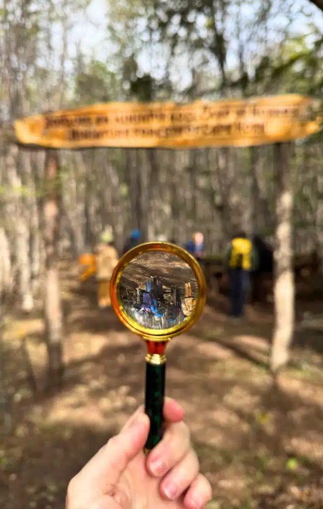
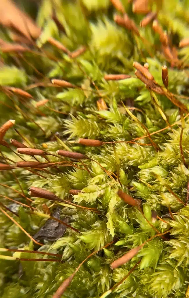
At first glance, the park looks like a pretty woodland but visit with a guide (we were joined once again by Javier from Wild Navarino as well as guides from the park) and you’ll quickly discover that the park has so much more to offer. It’s especially famous for its miniature forests, clusters of lichens, fungi and bryophytes (the group of plants that include mosses, liverworts and hornworts). In fact, this tiny corner of the planet holds more than 5% of the world’s bryophyte species, and more than half of them are found nowhere else.
One of the guides handed me a magnifying glass and as I crouched down to inspect a fallen log, a tiny world of comes into focus.
“Mosses were the first plants to conquer the land here after the glaciers retreated,” said Javier. “First there was bare rock, then moss and then slowly, over thousands of years, soil and eventually the forest that you see today.”
We spent a couple of hours here, enjoying the miniature forests, following the marked trails to learn more about the island’s flora and fauna, and learning more about Omora’s bird banding and research station. Along the way we heard the drumming of the Magellanic woodpecker, one of the largest woodpeckers in the world.
Museo Territorial Yagan Usi – Martín González Calderón
One of the highlights of my visit to Navarino Island was the afternoon that I spent at the Museo Territorial Yagan Usi – Martín González Calderón. The museum – the southernmost museum in the world – originally opened in 1975 and was rebuilt in 2008. More recently, it was reopened in 2024 after three years of working with the local Yagan community to better tell their story. It also underwent a name change having originally been called the Martin Guisinde Anthropological Museum.
I admit that I did not know much about the history of Navarino Island before my visit and this museum did an incredible job of filling in the many gaps and I would highly recommend that you visit early on in your visit as everything else that you do on the island will mean much more.
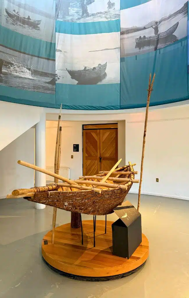
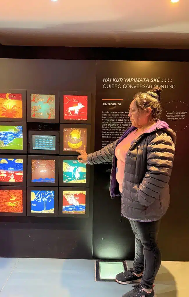
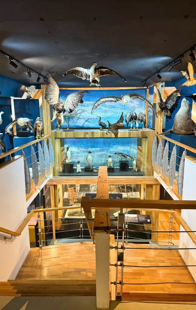
It explores the history and culture of the Yagan people, as told by them. It’s modern, well-designed and covers everything from navigation and ceremonies to hunting and food-gathering. It’s also genuinely interactive – there are touch panels that let you hear Yagan words spoken allowed for example.
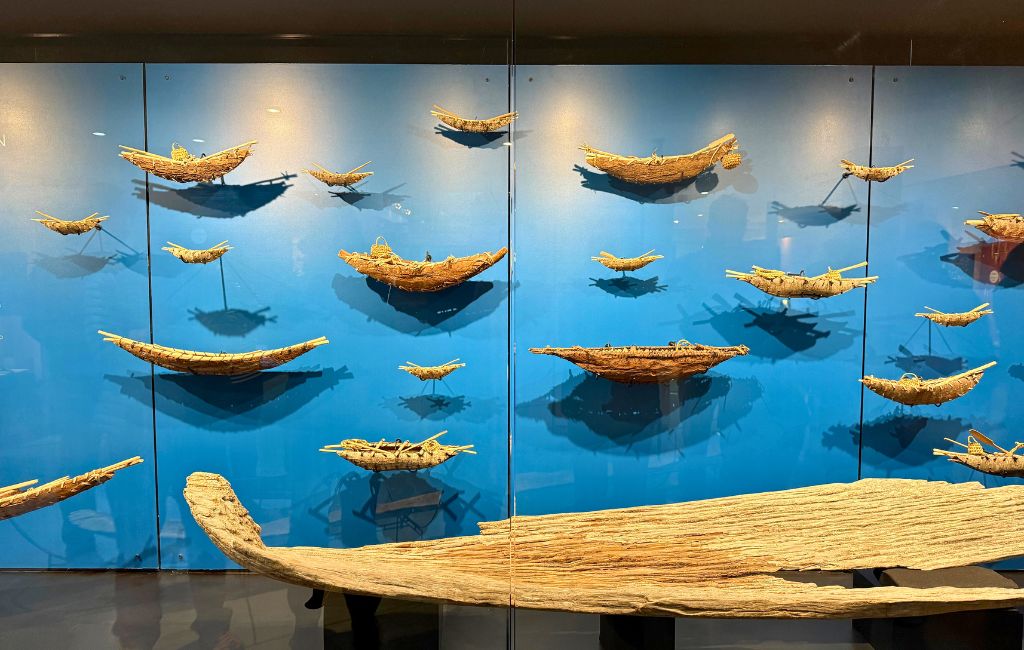
A large section covers the Yagan and their canoes, that they used for fishing and hunting. Typically between 7 and 10 metres long, the entire family would set sail, with a fire burning in the middle that the children were responsible for keeping alight. Women would dive into the icy waters for shellfish while the men managed the canoe and hunted larger marine mammals from above. The Yagan wore little or no clothing and, instead, rubbed seal and whale fat into their skin to protect themselves from the cold.
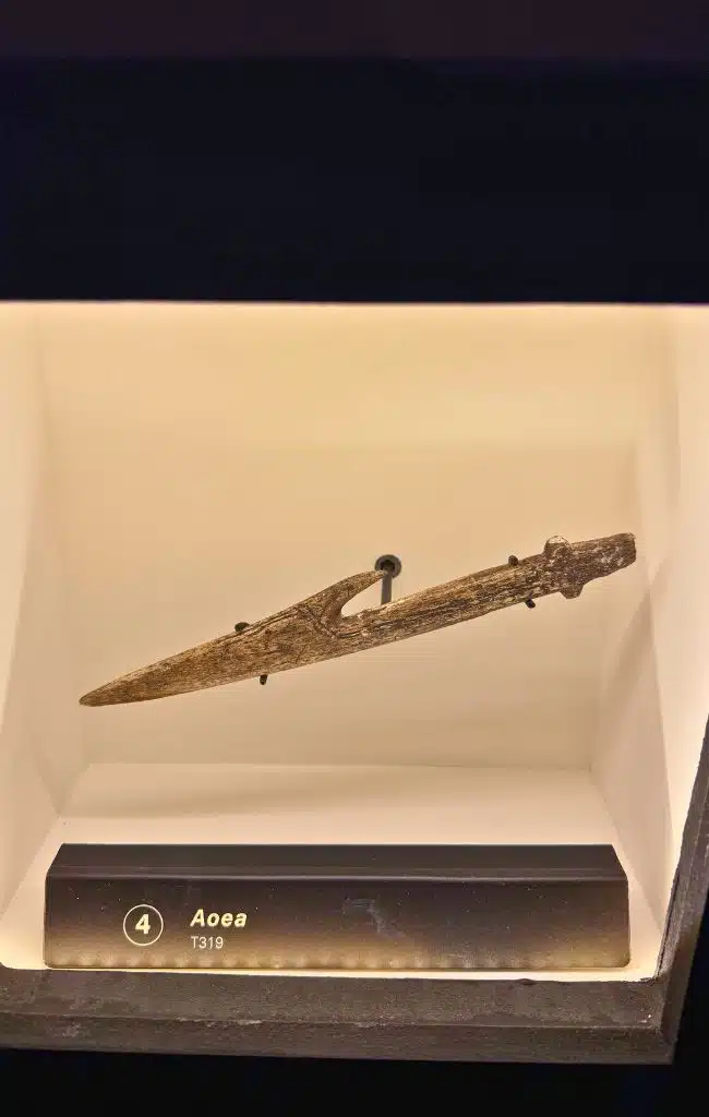
Also on display are hunting equipment, including a fragment from a harpoon thought to be between 6,400 and 7,200 years old; flint used to make fire; traditional woven baskets once used by the Yaghan people; and an example of the mask made form sea lion skin once worn during the men-only Kina ceremony.
Most disturbing is the section dedicated to the arrival of the Europeans, including Captain Robert FitzRoy in 1830 who kidnapped Jemmy Button and three other Fuegians, taking them back to England with the idea of “civilising” them. In the early 1900s, the gold rush brought diseases that devastated the Yagan population.
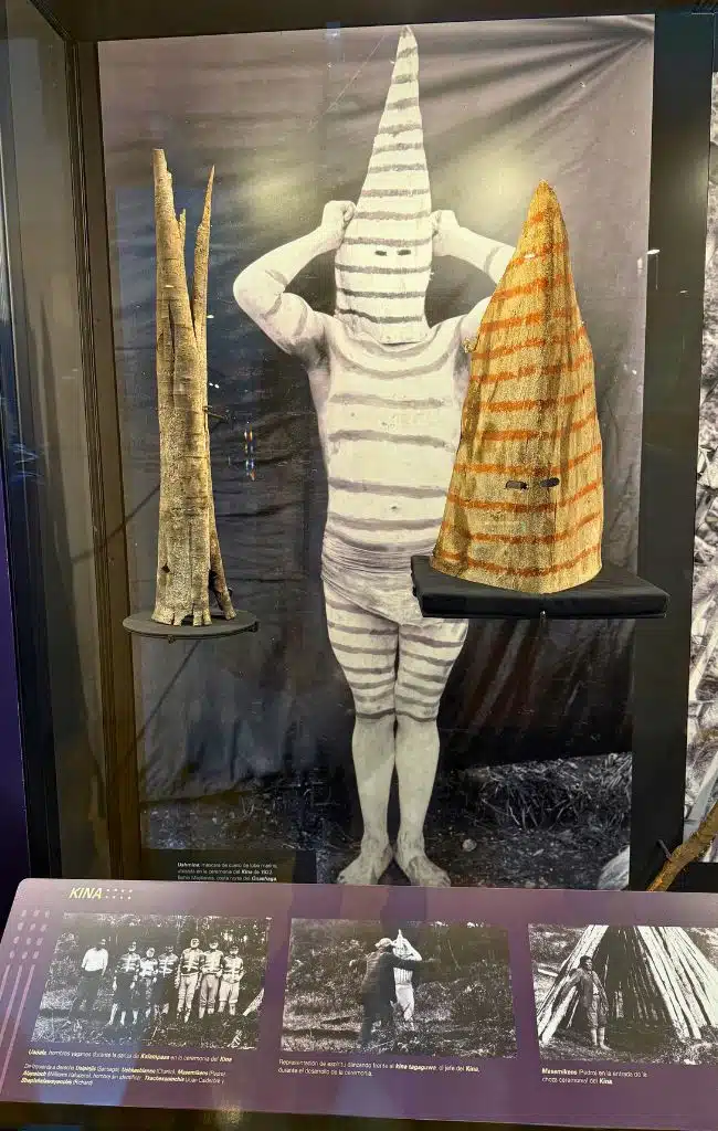
Interestingly, much of what is on display in the museum – the photographs, records and recordings – were made by European missionaries and colonisers. These include Anglican missionary Thomas Bridges and his son Lucas. Thomas complied a Yagan dictionary of more than 30,000 words.
At the entrance to the museum stands Casa Stirling, the oldest European house in Tierra del Fuego. This small prefabricated wooden house was built without nails in Ushuaia in 1871 for the Anglican mission. It was later moved to Douglas on the west of Navarino Island, abandoned, and finally brought to Puerto Williams.
Exploring Puerto Williams
Puerto Williams might be the southernmost city in the world, but don’t arrive expecting a city. This is a small, windswept town of wooden houses on the edge of the Beagle Channel with the snow-capped “dientes” rising behind it.
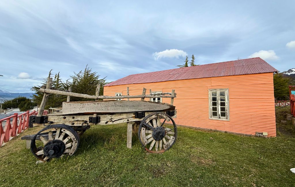
The city was founded as a naval base in 1953, and the navy still shapes much of daily life. The town is roughly divided into three communities. There are the navy families, many posted here for a couple of years on what’s considered a hardship posting. There are people from elsewhere in Chile who came here and fell in love with the place. And across the river is Villa Ukika, home to the Yagan community.
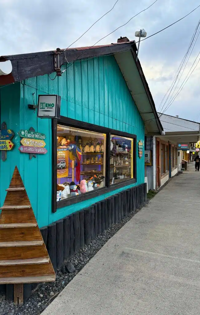
Life here is simple. There’s one small supermarket, one clothes shop, a single disco and the only petrol station on the island, which is reputedly the most expensive in Chile. Almost everything arrives by ferry from Punta Arenas, so stocks can run low before the next delivery. Homes are single-storey and built from native lenga wood, with zinc roofs and walls to keep out the inclement weather.
Look out for the flag of the Magallanes region flying around town. Its yellow represents the land, the blue the sky and the white the snow, with the Southern Cross picked out in stars. Officially, this is the Magallanes and Chilean Antarctic Region.
At the harbour is the Micalvi, a former navy supply ship that ran aground here and now serves as a bar and meeting point for yachts on their way to Cape Horn. Every boat heading for the Horn has to stop in Puerto Williams to register with the navy.
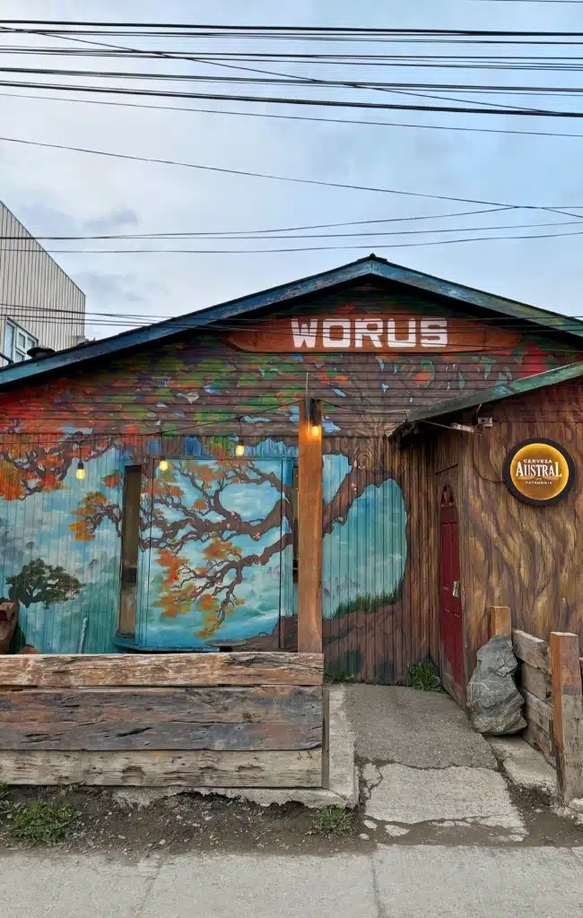
The Worus Resto-Bar in Puerto Williams is a good spot for dinner. We also had a Pisco tasting here, which was a lot of fun.
Kayaking the Beagle Channel with Tanana Navegacion
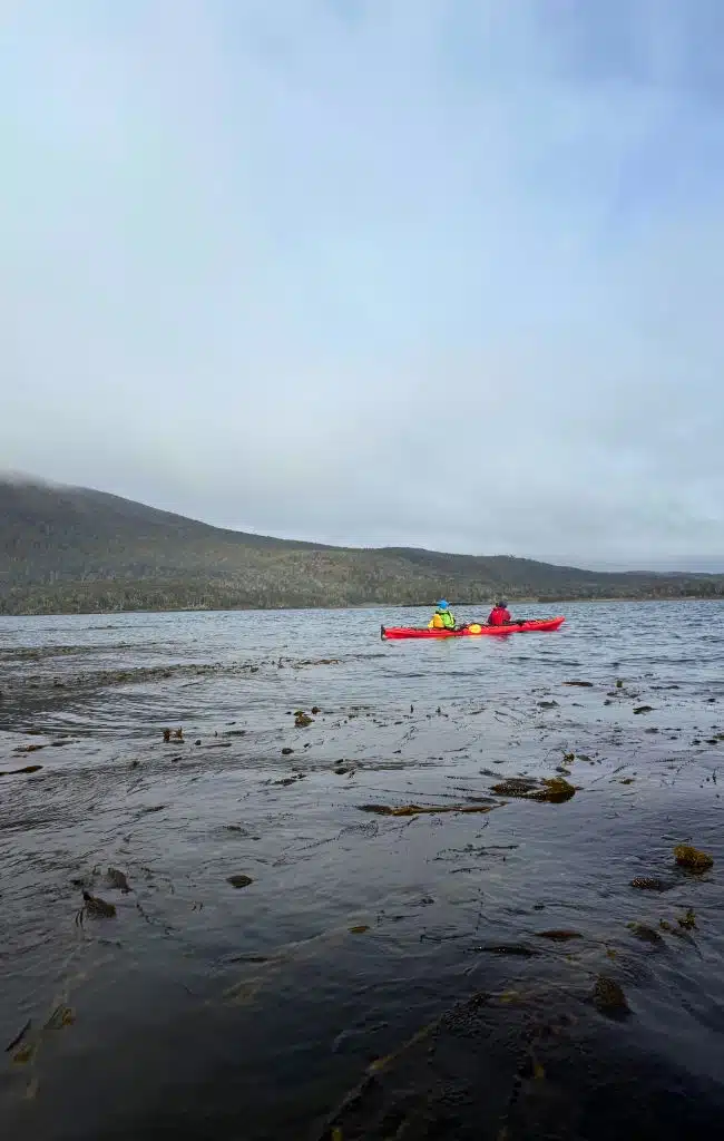
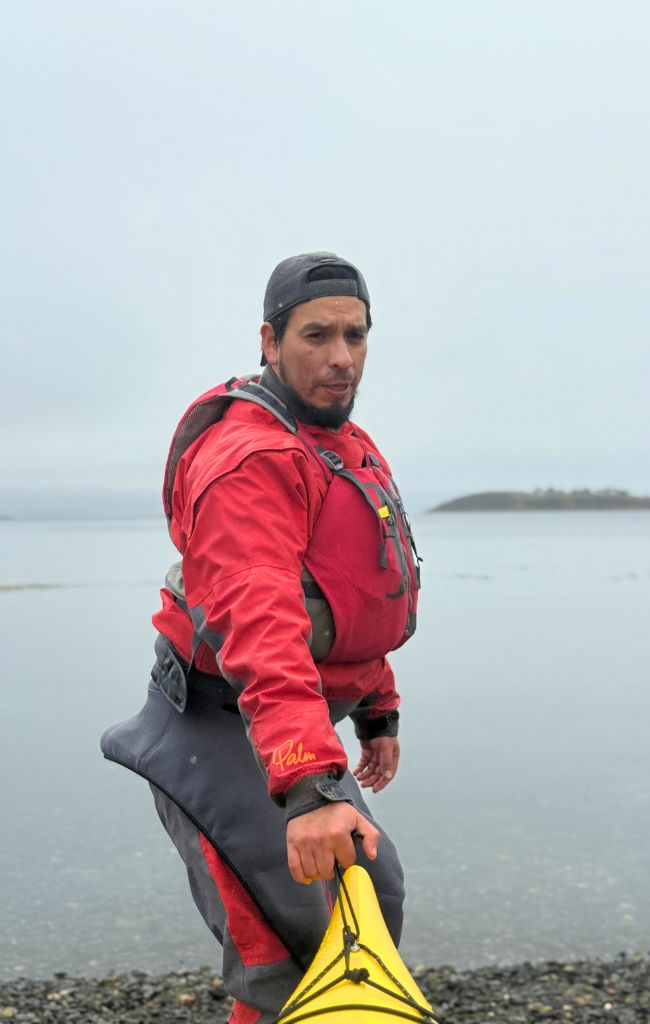
One of the highlights of my time on Navarino Island was a morning on the water with David Alday Chiguay. David is Yagan, born and raised on the island, and his family has lived here, as he puts it, “since forever”. About seven years ago he and his family set up Tanana, which means “ready to sail” in Yagan. It’s the only company on the island dedicated purely to kayaking and for David, it’s a way of reconnecting with the waters that his ancestors paddled for thousands of years.
Dressed in drysuits, we paired up and slipped our kayaks into the Beagle Channel, paddling over deep teal water and gliding across great swathes of kelp forest that swayed just below the surface. Kelp, David explained, was once used by the Yagan as medicine. Imperial cormorants stood on the rocky islets, upright in their black-and-white plumage that, from a distance, you could easily mistake them for penguins. Elsewhere, sea lions sprawled on jagged rocks before slipping lazily back into the water.
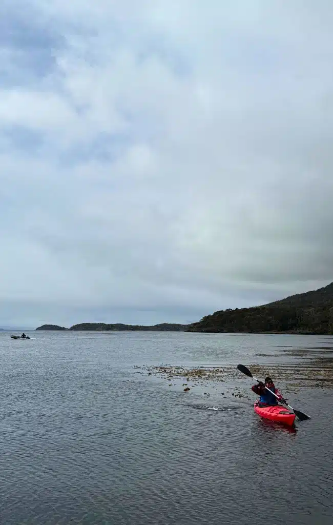
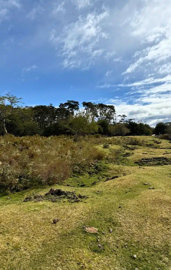
Halfway through, we pulled the kayaks up onto a quiet beach beside a conchal, or shell midden, one of many archaeological sites along this coast. The Yagan would build shelters along the shoreline rather than in the forest where they believed that the monster Hanuch lived.
One of their main food sources were shellfish, which the women would collect by diving into the icy waters, and they discarded the empty shells around the shelters. Over time, this left the distinctive undulating mounds – known as middens – that you can still see today.
Boat Trips
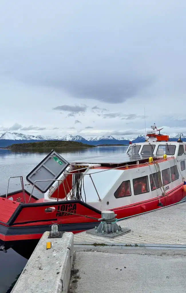
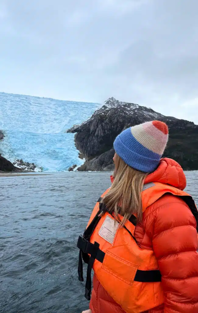
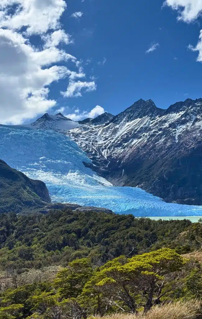
If you choose to stay at Errante Ecolodge then talk with Jorge about possible boat trips. We enjoyed an incredible day trip with him exploring the Holland Glacier and, later, enjoying a barbecue on the almost uninhabited Kanasaka island.
This particular boat trip departed from Puerto Navarino, an hour’s drive west of Puerto Navarino. This was the original choice for at the island’s main settlement but the lack of natural water meant that Puerto Williams got the role instead. One building, a former police station, remains here, its yellow paint peeling from the walls.
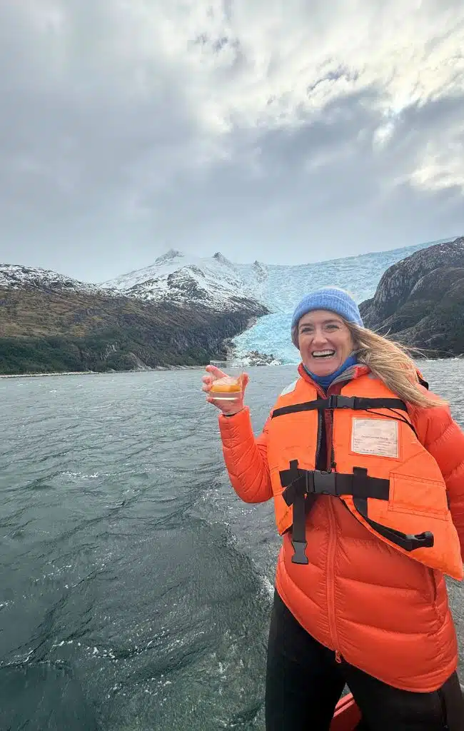
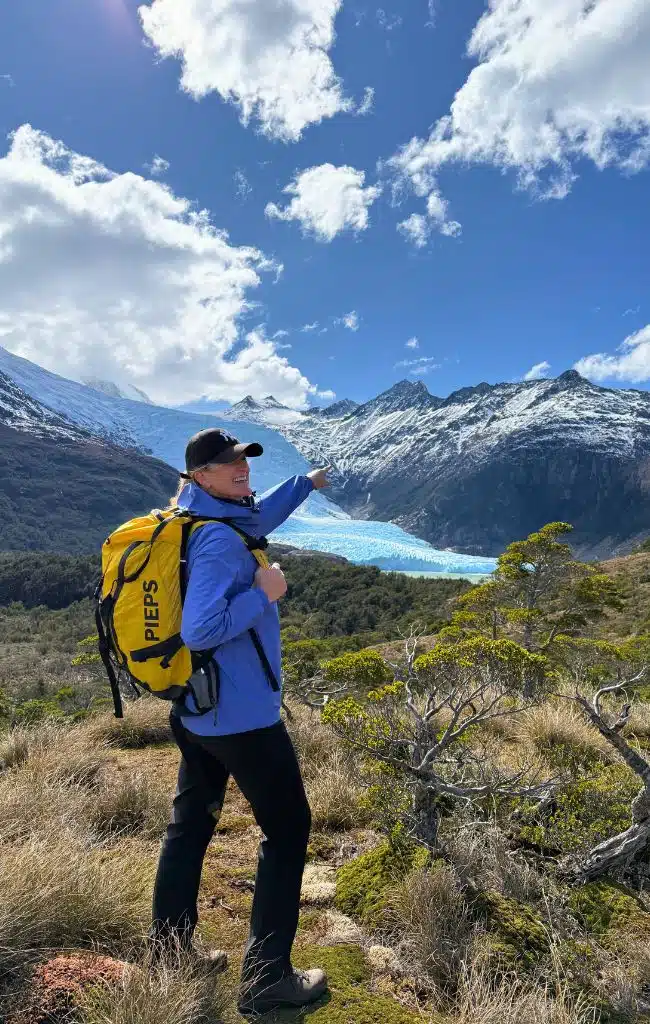
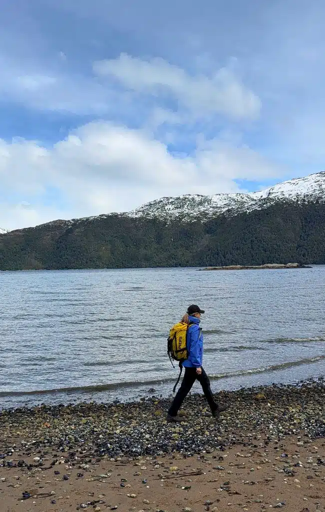
A boat really is one of the best ways to appreciate just how vast this region is and there, waiting at the dock, was Jorge’s boat. The 23-seat fast passenger launch was captained by Arturo, a dreadlocked and endlessly animated local who, at one point, fished glacier ice from the waters so that we could enjoy Pisco on the (glacial) rocks.
We passed rocky outcrops crowded with Magellanic penguins and imperial cormorants, passed enormous glaciers and eventually stopped, docking between to national Parks, Yendegaia and Alberto de Agostini.
The sun came out as we walked along the sand, condors circling lazily overhead, and made our way up through spongy, moss-covered peat bog. Eventually, the Holland Glacier came into view, a jumble of pale blue and turquoise icefalls and crevasses, flanked by granite peaks and Magellanic sub polar forests.
Lunch on Hoste Island
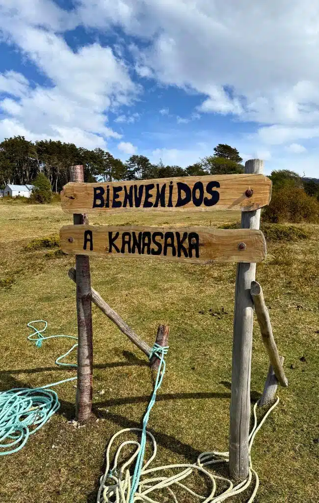
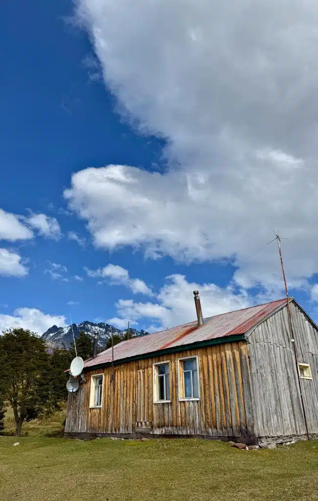
Heading back to Navarino Island we stopped at Hoste Island, one of the largest islands in Chilean Patagonia. There, one family have lived for generations, running a sheep and horse estancia called Kanasaka. They are the islands only inhabitants and we were greeted by Carlos, the adult son of the current owners, who treated us to lunch.
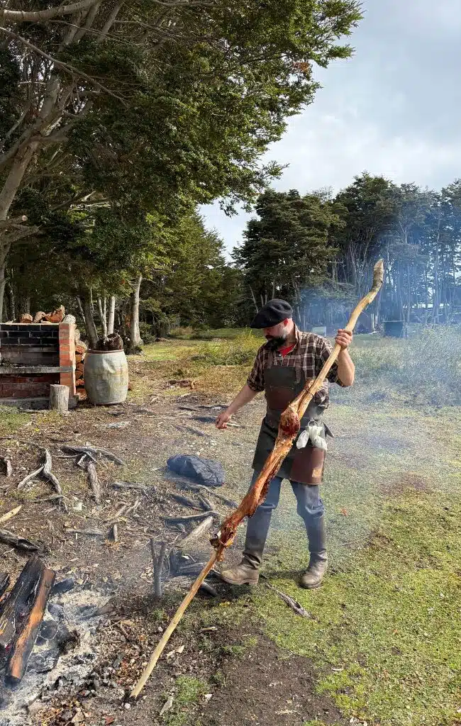
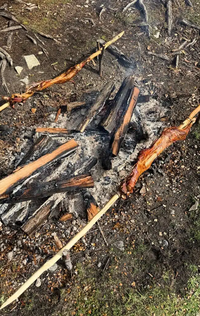
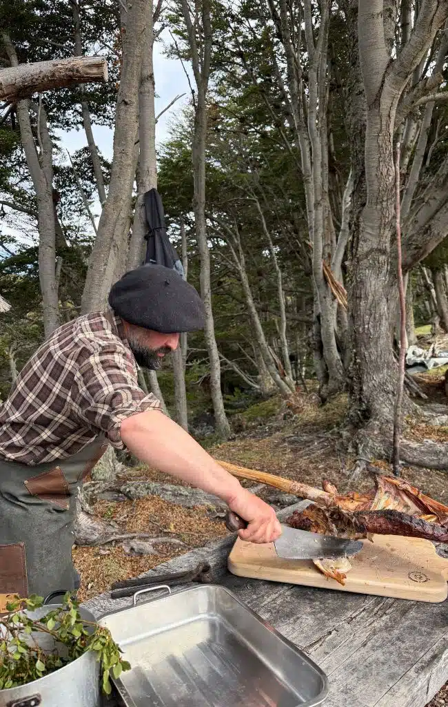
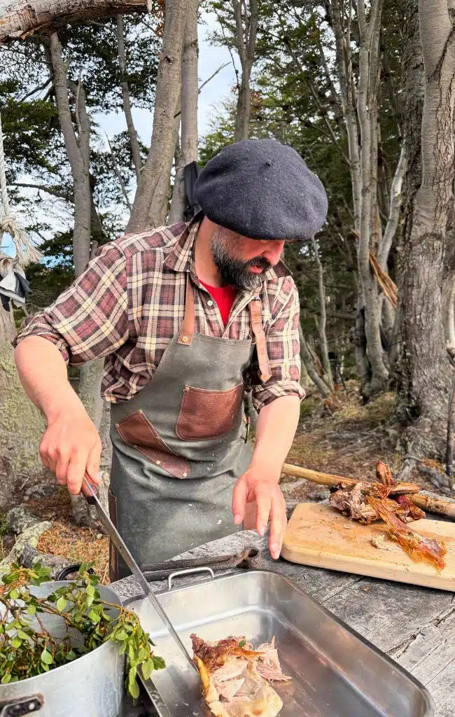
Dressed in his traditional gaucho beret, with a knife tucked into his waistband and knee-high black boots, Carlos tended to the asado. Two whole lambs had been roasting slowly over an open fire for four hours and, shortly after our arrival, Carlos removed and carved them for what has to be one of the world’s most unique – and tastiest – lunches al fresco.

“Las Onces” at Santa Rosa Estancia
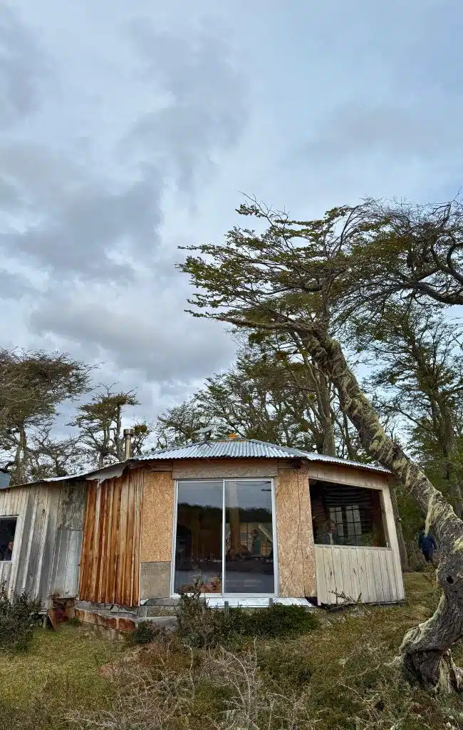
Returning to Navarino Island, Jorge drove us to Santa Rosa Estancia, the oldest historic ranch on the island. Perched at the edge of Laguna Kimoa, at the end of a winding forest road, the ranch was founded in 1893 and is owned and managed by Maria-Luisa and Francisco Figueira, descendants of the Yagán.
Today, the family offer various activities for visitors including kayaking, hiking and the tradition of “las onces”, otherwise known in Britain as “elevenses”. We stopped for an hour or so to drink tea and eat cake, while learning more about the traditional Yaghan culture.
Where to Stay
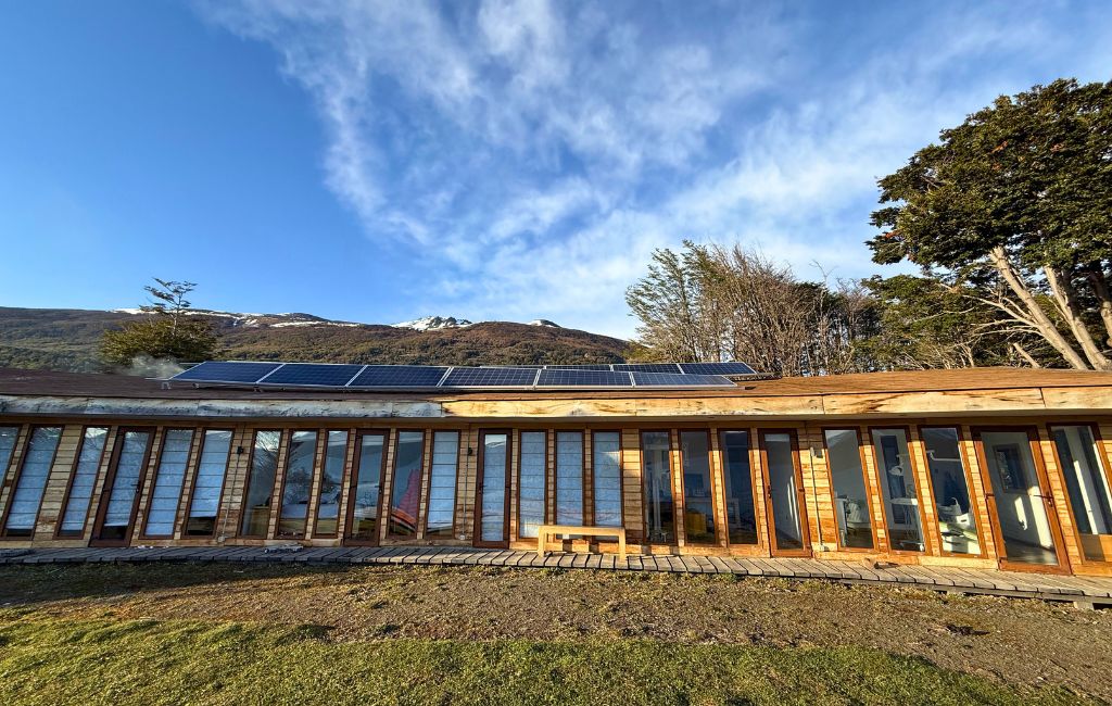
There’s not a huge choice when it comes to accommodation and almost all of it is in Puerto Williams. Just outside of town, however, is Errante EcoLodge and this really is a fantastic place to stay.
Built, owned and managed by Jorge Caros Lara, a dentist from Santiago who fell in love with the island, this is a very special place to stay. The 11 rooms are each named after a tree from the island and are simple but very comfortable (and warm), and all look out over the Beagle Channel. There are seven double rooms, two triple rooms and two larger rooms sleeping up to five.
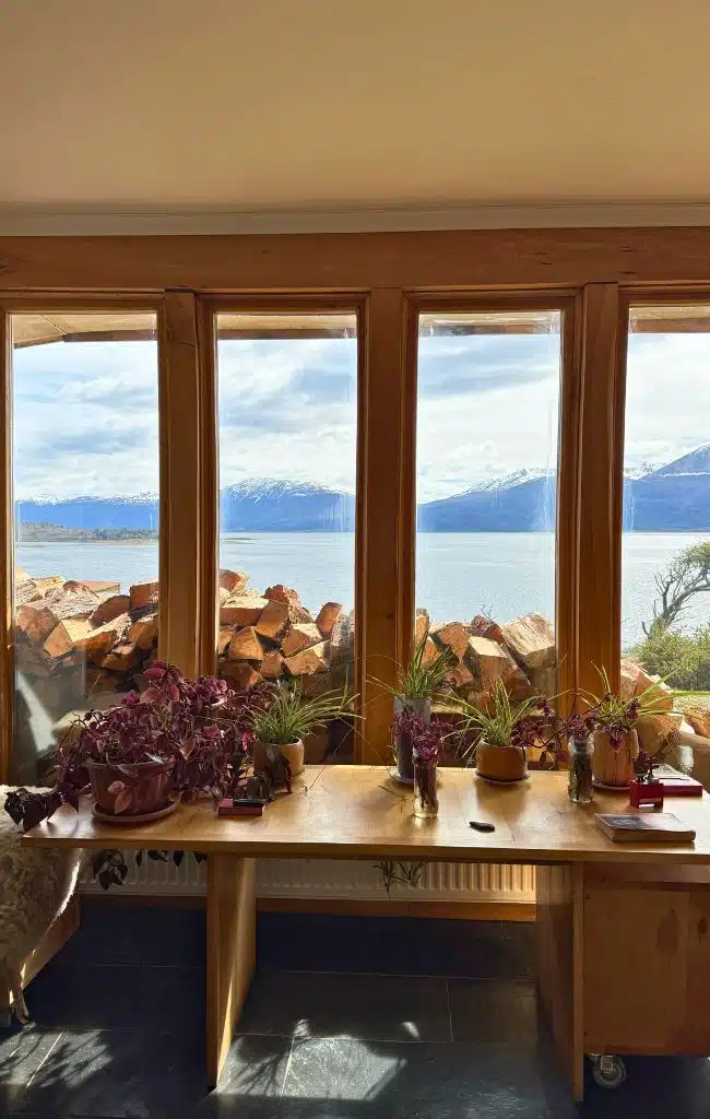
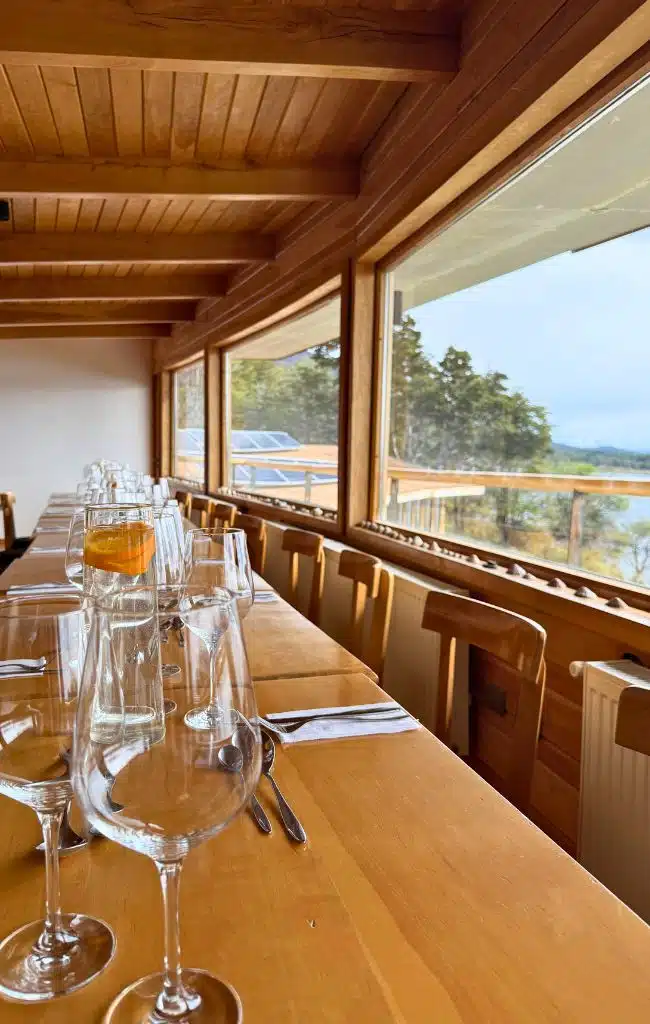
There’s a lounge area and an upstairs dining area where breakfast and dinner are served, also with views of the Beagle Channel. The food is excellent, particularly the king crab that we enjoyed on our first night.
What really makes this guesthouse stand out, however, are the staff and Jorge himself. He arrived to work in public health years ago and has never left. In addition to being the guesthouse owner he is a guide, owns a boat (and provides transport to Puerto Williams to some of the more remote-living residents), and still works as a dentist (you’ll spot this when you stay!).
He’s become such a pillar of the community that his profile photo hangs in the airport alongside other notable local residents.
Whether you choose to stay at Errange Ecolodge or not, if you are visiting during the peak months then make sure to book well ahead.
Where to eat
Navarino Island might not have a gourmet reputation but we ate extraordinarily well at Errante Ecolodge. As well as an enormous, freshly caught king crab, we enjoyed trout and octopus ceviche, roasted lamb with polenta and Calafate (the local blueberry-like berry), and hake served with beetroot and carrot mash.
The Worus Bar is another option for dinner. We enjoyed an evening tasting Magellanic regional beers and Chilean pisces with pairings, led by beer sommelier Benjamín González Donoso. Even if you don’t opt for this, it’s worth popping into the restaurant to experience a slice of local life.
Visiting Navarino Island with kids
I’m a firm believer that you can take kids anywhere and Navarino Island is no exception, you just need to be prepared. It’s a great destination for families with older kids who love the outdoors. It is also great for curious children interested in nature, ships and “end of the world” stories.
- Things to do: Omora Park’s short trails and the moss hunting with a magnifying glass. Waterfront walks to spot boats and seabirds. The anthropological museum, which has canoes, tools and wildlife displays, plus interactive elements.
- Cerro Bandera: Doable for older children used to walking. The weather can be challenging so make sure you pack layers, rain gear and plenty of snacks.
- Not for kids: The full Dientes circuit, unless your teenagers are very experienced backpackers.
- Packing: Waterproof layers, warm hats and gloves, sturdy waterproof boots, snacks and entertainment for delays. There are very few shops so you’ll need to bring whatever you need with you.
- Transport: The short flight is easiest with younger kids but we aware of the weight limits for luggage. The 30-hour ferry suits families who enjoy slow travel and scenery.
- Health: Medical facilities are basic, so bring a full family first-aid kit and any medicines you need.
Practical tips
Money
- Bring Chilean pesos. ATMs are very limited and can run out of cash.
- Cards are accepted in many places, but not all. Carry cash for small purchases.
- If you arrive from Ushuaia, change some money before you travel.
Connectivity
- There is mobile signal in town but none on the trails.
- Download offline maps and trail GPX files in advance.
Guides
- Chile Nativo: I travelled to Navarino Island with them, with our guide Pepa, and they were excellent.
- Wild Navarino: Javier accompanied us on our walk up past Cerro Bandera and on the boat trip. He’s a highly knowledgeable guide, particularly when it comes to the island’s flora and fauna.
Safety on trails
- Register your Dientes de Navarino trek with the Carabineros (this is mandatory).
- Carry a GPS or satellite messenger for multi-day hikes.
- Weather changes fast. Turn back on passes in high wind or whiteout.
- Expect river and bog crossings. Gaiters help.
Packing essentials
- Full waterproofs, a warm insulating layer, and a hat and gloves, even in January.
- A tent rated for strong wind if you plan to trek.
- Sunscreen and sunglasses. The sun is strong when it appears, and the days are long.
Logistics
- Book flights, beds and any boat trips early for summer.
- Leave buffer days for cancellations.
- Most services are closed on Sundays or close early that day.
- Remember the baggage weight allowance for flights (10 kg).
Responsible travel
- Ask before photographing people, especially in the Yagán community.
- Follow Leave No Trace, particularly on the Dientes trek, where there are no facilities or bins.
- Do not bring fresh food across the border.
- It’s illegal to take anything from the middens.
Frequently Asked Questions
- Is Navarino Island worth visiting? In a word, yes, It’s ideal for travellers searching for a true adventure and for those who value wild landscapes, quiet and cultural depth over comfort and convenience.
- Is Puerto Williams really the southernmost city in the world? Chile granted it city status in 2019, which supports the claim. Ushuaia is larger but lies further north. Tiny Puerto Toro, also on Navarino, is further south still, but it is a village.
- Can I visit Navarino Island as a day trip from Ushuaia? It is possible in summer when boats run, but it is rushed. Weather can strand you, so stay at least one night.
- How hard is the Dientes de Navarino circuit? It is challenging. The route is remote and only partly marked, with steep scree, bog and harsh weather. It is best for experienced hikers who can navigate independently.
- Do I need a guide for the Dientes circuit? A guide is not required, but registration with the Carabineros is. Hire a local guide if you are unsure of your navigation skills.
- Do I need a visa? Many nationalities can enter Chile visa free as tourists. Check current rules for your passport before you travel.
- Are there any wildlife dangers? There are no large predators. The main risks are weather, cold and terrain.
- Can I see penguins on Navarino Island? Penguins are not a main attraction here. Boat trips from Ushuaia or further afield offer better chances.
- Is there an ATM in Puerto Williams? Usually there is one, but it might not always have cash. Arrive with enough cash.